The Americas: One Hemisphere, Countless Worlds
The Americas, often called America in a broader context, encompass the lands of the Western Hemisphere. These vast regions are defined variably by geography, politics, and culture. They span diverse environments and contain a patchwork of countries and territories that reflect centuries of cultural history.

The Americas: An Overview of Geography, History, and Culture
The Americas constitute the entire landmass of the Western Hemisphere, stretching from Cape Morris Jesup in northern Greenland — the world's most northerly point of land, lying at 83°N latitude just 740 kilometers (460 miles) from the North Pole — to Cape Horn at 55°S, where the cold waters of the Drake Passage separate South America from Antarctica. End-to-end, the hemisphere spans roughly 15,000 kilometers (9,300 miles) of latitude and encompasses a total land area of approximately 42 million square kilometers (16.2 million square miles), nearly 30% of Earth's land surface. Within that immensity, a greater range of environments exists than on any other comparable land area: Arctic ice sheets and equatorial rainforests, hyperarid deserts and perpetually fog-drenched cloud forests, high-altitude plateaus and coastal mangrove systems at sea level.
The name "America" derives from Americus Vespuccius — the Latinized form of Amerigo Vespucci, the Florentine explorer whose letters of 1503 and 1504 persuaded European geographers that the lands Columbus had reached were not outlying parts of Asia but a distinct landmass previously unknown to them. The German cartographer Martin Waldseemüller applied the name "America" to the new southern continent on his landmark 1507 world map, and the designation gradually extended to encompass the entire hemisphere. Today, the Americas are home to approximately 1.05 billion people across 35 sovereign nations and numerous territories, speaking hundreds of languages and representing virtually every major cultural tradition on Earth.
Continental Divisions
The Americas are conventionally divided into two main continents — North America and South America — joined by the narrow land bridge of Central America. This binary framework, however, obscures considerable geographic and cultural complexity. North America alone encompasses the Arctic environments of Canada and Alaska, the temperate forests and prairies of the contiguous United States, the subtropical landscapes of Mexico, and the tropical lowlands of Central America. Geographers and anthropologists frequently recognize Mesoamerica as a culturally distinct zone bridging central Mexico and northern Central America, defined not by continental boundaries but by the shared civilizational traditions of its pre-Columbian peoples.
The continental model itself varies by tradition. In much of Latin America and continental Europe, the Americas are taught as a single continent — "América" — divided into North, Central, and South. In the English-speaking world, the two-continent model predominates. Neither framework is objectively correct; both reflect the cultural and pedagogical priorities of the societies that use them. What is not in dispute is the physical continuity of the landmass: the Isthmus of Panama, at its narrowest point just 80 kilometers (50 miles) wide, provides the land connection between the two main continental blocks and has been one of the most consequential geographic features in the history of life on Earth.
Major Geopolitical Regions
North America
In its broadest geopolitical sense, North America encompasses Canada, the United States, Mexico, the countries of Central America and the Caribbean, and a number of territories and dependencies including Greenland, Bermuda, and Saint Pierre and Miquelon. In common usage, however, "North America" often refers specifically to Canada, the United States, and Mexico — the three nations linked since 1994 by a free trade agreement that has since been updated as the United States–Mexico–Canada Agreement (USMCA).
The physical geography of northern North America is defined by some of the continent's most dramatic landscapes. The Rocky Mountains form a cordillera running roughly 4,800 kilometers (3,000 miles) from northern British Columbia to New Mexico, with numerous peaks exceeding 4,000 meters (13,100 feet). East of the Rockies, the Great Plains sweep across approximately 3.2 million sq km (1.24 million sq miles) — one of the world's great grassland systems, underlain by deep, fertile mollisol soils that have made the region among the most productive agricultural zones on the planet. The Great Lakes, straddling the U.S.-Canadian border, collectively hold about 21% of the world's surface fresh water by volume, forming an inland freshwater sea that has shaped settlement, industry, and ecology across the region for millennia.
Canada, the world's second-largest country by total area at nearly 10 million sq km (3.85 million sq miles), is dominated in its northern two-thirds by boreal forest and Arctic tundra — the world's largest terrestrial biome. The Canadian Shield, an ancient Precambrian rock formation covering about half the country, was scoured clean by Pleistocene glaciers that retreated roughly 10,000 years ago, leaving behind a landscape of exposed bedrock, thin soils, and hundreds of thousands of lakes. The United States, covering about 9.8 million sq km (3.8 million sq miles), contains within its borders the subtropical wetlands of the Florida Everglades, the temperate rainforests of the Pacific Northwest, the volcanic peaks of the Cascade Range, and the tectonic extremes of Death Valley at 86 metres (282 feet) below sea level and Denali (formerly Mount McKinley) at 6,190 metres (20,310 feet) — the highest peak in North America.
Before European contact, North America was inhabited by hundreds of distinct Indigenous nations with populations estimated between 2 and 18 million, depending on the methodology applied. These societies ranged from the pueblo-building cultures of the Southwest, whose multi-story stone structures at sites like Chaco Canyon date to the 9th century CE, to the mound-building civilization centered at Cahokia near present-day St. Louis, which at its peak around 1100 CE housed a population that may have exceeded 15,000 — larger than contemporary London.
Mesoamerica
Mesoamerica is a cultural and historical region, not a political one. The term was coined by the German-Mexican anthropologist Paul Kirchhoff in 1943 to designate the area stretching from roughly the Tropic of Cancer in central Mexico southward through Guatemala, Belize, El Salvador, Honduras, and western Nicaragua and Costa Rica — a zone defined by a cluster of shared cultural traits that distinguished its pre-Columbian inhabitants from neighboring peoples. These traits included the cultivation of maize (Zea mays) as the dietary and ceremonial foundation of civilization, the use of a 260-day ritual calendar alongside a 365-day solar calendar, the construction of stepped pyramidal temples, the practice of a ritual ballgame played in masonry courts, and the development of writing systems.
The Olmec civilization, which flourished along the Gulf Coast of present-day Veracruz and Tabasco between approximately 1500 and 400 BCE, is widely regarded as the foundational culture from which later Mesoamerican civilizations drew. The Olmec produced the hemisphere's earliest confirmed monumental sculpture — colossal stone heads up to 3.4 meters (11 feet) tall and weighing up to 40 metric tons (44 short tons), carved from basalt transported more than 100 kilometers (62 miles) from quarries in the Tuxtla Mountains. Their iconography — the were-jaguar motif in particular — reappeared across Mesoamerica for centuries after the decline of Olmec society.
The Maya civilization, which developed across the Yucatán Peninsula, Guatemala, Belize, and adjacent areas, reached its Classic Period peak between approximately 250 and 900 CE, at which point the Maya maintained dozens of city-states with populations in the tens of thousands, connected by trade networks and diplomatic relationships of considerable sophistication. Maya mathematicians independently developed the concept of zero and used a positional numeral system that allowed them to perform calculations of great precision. Their astronomical records tracked the cycles of Venus to within a few minutes of accuracy per year. The Maya hieroglyphic script — the only fully developed writing system in the pre-Columbian Americas — remained undeciphered until the late 20th century, when the combined efforts of epigraphers including Yuri Knorozov, Tatiana Proskouriakoff, and Linda Schele revealed a historical record of astonishing richness: royal genealogies, war narratives, and ritual texts stretching back to the 1st century CE.
The Aztec civilization (more precisely, the Mexica) rose to dominance in central Mexico in the 14th and 15th centuries, establishing a tribute-based empire that, at its height in the early 16th century, extracted resources from roughly 400 to 500 subject city-states across an area of approximately 200,000 sq km (77,000 sq miles). Their capital, Tenochtitlán, was built on an island in Lake Texcoco and connected to the mainland by causeways. When the Spanish conquistador Hernán Cortés arrived in 1519, he described Tenochtitlán as larger and more orderly than any city in Spain. Contemporary estimates place its population between 200,000 and 400,000, making it one of the five largest cities in the world at the time.
Central America
Central America comprises seven nations — Guatemala, Belize, Honduras, El Salvador, Nicaragua, Costa Rica, and Panama — occupying the narrow isthmus between Mexico and South America. The region covers approximately 524,000 sq km (202,000 sq miles), about the size of France, yet contains extraordinary geographic and biological diversity. A chain of more than 40 volcanoes lines the Pacific margin, marking the boundary where the Cocos tectonic plate subducts beneath the Caribbean plate. Guatemala's Volcán Tajumulco rises to 4,220 meters (13,845 feet), the highest point in Central America; Nicaragua's Masaya volcano maintains one of the world's few persistent lava lakes.
Central America's position as a land bridge has given it biological significance far beyond what its size might suggest. The Great American Biotic Interchange — the mixing of North and South American fauna that began when the Isthmus of Panama closed approximately 3 million years ago — produced a collision of evolutionary lineages whose effects are still visible today. North American mammals, including tapirs (Tapirus bairdii), peccaries (Pecari tajacu), and deer, moved south, while ground sloths, glyptodonts, and ancestors of modern llamas and horses moved north. The region today harbors roughly 8% of the world's biodiversity on just 0.5% of Earth's land surface.
Politically, the modern states of Central America emerged from the breakup of the Federal Republic of Central America in 1838–1841, itself a successor to the colonial Captaincy General of Guatemala. Spanish colonization had restructured the region's societies profoundly, decimating Indigenous populations through disease — some estimates suggest a demographic collapse of 80–90% in the century following European contact — and reorganizing survivors into a forced labor system known as the encomienda. The region's complex colonial legacy continues to shape political dynamics, land tenure patterns, and social inequality across all seven nations.
The Caribbean
The Caribbean archipelago comprises more than 7,000 islands, cays, and islets distributed across the Caribbean Sea between North and South America, with a combined land area of approximately 230,000 sq km (89,000 sq miles). The islands are geologically divided between the larger, older limestone and metamorphic platforms of the Greater Antilles — Cuba, Hispaniola, Jamaica, and Puerto Rico — and the younger volcanic arc of the Lesser Antilles, where the Atlantic plate's subduction beneath the Caribbean plate continues to generate eruptions, earthquakes, and tsunamis.
The Caribbean's human history is among the most turbulent and consequential of any small region on Earth. The Taíno, an Arawak-speaking people who had settled the Greater Antilles by around 700 CE, were the first Indigenous people encountered by Christopher Columbus in October 1492. Within half a century of contact, the Taíno population of Hispaniola — estimated at between 250,000 and 1 million at the time of Columbus's arrival — had effectively collapsed due to epidemic disease, forced labor, and violence. The ensuing labor shortage drove the rapid expansion of the transatlantic slave trade: between 1500 and 1900, approximately 4 to 4.5 million enslaved Africans were transported to the Caribbean, representing roughly a third of the entire Atlantic trade. The cultural, demographic, and social consequences of this history remain foundational to Caribbean identity across every island.
Today, the Caribbean is a mosaic of 13 sovereign nations and more than a dozen dependent territories of the United Kingdom, France, the Netherlands, and the United States. This political fragmentation reflects the intensity of colonial competition over these islands, which for several centuries produced the majority of the world's sugar, coffee, and indigo through the labor of enslaved people. The island of Hispaniola, at 76,480 sq km (29,530 sq miles), the second-largest in the Caribbean, is uniquely divided between two nations: Haiti, which declared independence in 1804 following the only successful slave revolt in history to establish a new country, and the Dominican Republic. Their shared border separates vastly different political, linguistic, and ecological trajectories — Haiti's western third is largely French-speaking and has suffered more severe deforestation, while the Dominican east retains larger forest cover and a Spanish-speaking majority.
South America
South America is the world's fourth-largest continent, covering approximately 17.8 million sq km (6.9 million sq miles). It is home to 12 sovereign nations — Argentina, Bolivia, Brazil, Chile, Colombia, Ecuador, Guyana, Paraguay, Peru, Suriname, Uruguay, and Venezuela — along with French Guiana, an overseas department of France. Brazil alone occupies 8.5 million sq km (3.3 million sq miles), making it the world's fifth-largest country and home to roughly half of South America's 440 million people.
The continent's geography is organized around three great structural elements. The Andes, running 7,000 kilometers (4,350 miles) along the western margin from Venezuela to Tierra del Fuego, represent the world's longest continental mountain range and contain the Western Hemisphere's highest peaks, including Aconcagua at 6,961 meters (22,838 feet) in Argentina. The Guiana Highlands in the northeast, among the world's oldest geological formations at nearly 1.7 billion years, give rise to tepuis — flat-topped sandstone mesa mountains whose sheer walls and isolation have produced extraordinary endemic flora and fauna. Rising from the tepuis of Venezuela, Angel Falls (Kerepakupai Merú) plunges 979 meters (3,212 feet) in a single unbroken drop — the world's highest waterfall, nearly 20 times the height of Niagara Falls. The third structural element is the lowland river basins that drain the interior: the Amazon in the north, the Paraná–Paraguay system in the center, and the Orinoco, which drains the vast llanos grasslands of Venezuela and Colombia.
South America was also home to the Western Hemisphere's largest pre-Columbian civilization: the Inca Empire (Tawantinsuyu), which at its peak in the early 16th century extended approximately 4,000 kilometers (2,500 miles) along the Andes from present-day Colombia to central Chile, governing a population estimated at between 10 and 15 million people. The Inca achieved this governance without a written language, relying instead on a recording system of knotted strings called quipu that could encode numerical and potentially narrative information. Their road system, running some 40,000 kilometers (25,000 miles) through some of the world's most challenging terrain, rivaled the Roman road network in engineering ambition.
Cultural and Linguistic Regions
Latin America is the cultural and linguistic region of the Americas where Romance languages — those derived from Latin through the medium of Iberian colonialism — predominate. Spanish is the primary language of 18 nations; Portuguese is the language of Brazil, the continent's most populous country. French, a third Romance language with colonial roots in the hemisphere, is spoken in Haiti, French Guiana, Martinique, Guadeloupe, and several smaller Caribbean territories. Together, these Spanish-, Portuguese-, and French-speaking nations constitute Latin America — a cultural zone defined not by physical geography but by a shared heritage of Iberian colonialism, Catholic Christianity, and the blending of Indigenous, European, and African peoples and traditions.
Latin America is home to some 480 million Spanish speakers, making it the world's largest Spanish-speaking region by far; Spain itself accounts for only about 47 million. Brazil's 215 million Portuguese speakers represent roughly half of all native Portuguese speakers on Earth. Beneath these dominant colonial languages, a remarkable number of Indigenous tongues survive. Quechua, spoken by an estimated 8–10 million people across the Andes, and Guaraní, co-official with Spanish in Paraguay and spoken by the majority of that country's population, are the most widely used. Nahuatl, Yucatec Maya, Aymara, and dozens of other languages continue to be spoken by communities whose roots in the Americas predate colonialism by thousands of years.
Anglo-America — the United States and Canada — and the English-speaking Caribbean constitute a distinct cultural zone defined by British colonial heritage, Protestant Christianity (in its majority), and the English language, though Canada's Québec province is a significant Francophone exception, and the demographic complexion of both the United States and Canada is increasingly shaped by Latin American, Asian, and African immigration.
Key Geographic Features
The Americas contain an exceptional concentration of the world's most significant geographical features. The Amazon River, draining a basin of approximately 7 million sq km (2.7 million sq miles) — roughly the area of Australia — discharges around 209,000 cubic meters (7.4 million cubic feet) of water per second into the Atlantic Ocean, more than the next seven largest rivers in the world combined. The river's influence on the global water cycle is profound: the Amazon Basin recycles so much water through evapotranspiration that it effectively generates its own rainfall, sustaining the forest that sustains the rain. Scientists have described this process as "flying rivers" — atmospheric moisture rivers carrying water westward from the Atlantic deep into the continent's interior.
The Mississippi–Missouri river system, the longest in North America at approximately 6,275 kilometers (3,900 miles) from the Missouri's source to the Mississippi's mouth, drains 40% of the contiguous United States and historically deposited enough sediment in the Gulf of Mexico to build the fertile delta on which New Orleans stands. The Paraná River, the second-longest in South America at about 4,880 kilometres (3,030 miles), drains portions of Brazil, Bolivia, Paraguay, and Argentina before joining the Uruguay River to form the vast Río de la Plata estuary — at roughly 35,000 sq km (13,500 sq miles), one of the world's widest river mouths, which in turn defines the geography of Buenos Aires and Montevideo.
Lake Titicaca, straddling the Peru–Bolivia border at an altitude of 3,812 meters (12,507 feet) above sea level, is the world's highest navigable lake and at 8,372 sq km (3,232 sq miles) the largest lake in South America. Its thermal mass moderates temperatures on the surrounding altiplano, making agriculture possible at elevations where crops would otherwise fail — a natural gift that the Tiwanaku and later Inca civilizations exploited through elaborate raised-field cultivation systems. At the opposite extreme, the Atacama Desert along Chile's coast receives less than 1 millimeter (0.04 inches) of rain annually in its driest zones, making it the most arid non-polar desert on Earth; some weather stations there have never recorded rainfall.
Historical Influences
The foundational historical event in the modern Americas is the encounter between European and Indigenous civilizations that began with Columbus's landfall in the Bahamas on October 12, 1492. What followed was, by any measure, one of the most consequential series of events in human history. The Spanish conquistadors who followed Columbus — Hernán Cortés in Mexico (1519–1521), Francisco Pizarro in Peru (1532–1533), and dozens of lesser-known figures elsewhere — dismantled the most powerful states in the hemisphere within a generation, aided decisively by epidemic diseases to which Indigenous populations had no prior exposure. Smallpox, measles, typhus, and influenza spread far ahead of European armies, killing an estimated 50–90% of the hemisphere's pre-contact population within a century — a demographic catastrophe without parallel in recorded history.
The transatlantic slave trade, which transported an estimated 12.5 million Africans to the Americas between the early 16th century and the late 19th century (with roughly 10.7 million surviving the crossing), was the other great shaping force of the modern hemisphere. Enslaved Africans and their descendants built the plantation economies of the Caribbean, Brazil, and the southern United States, and their cultural contributions — in music, cuisine, religion, language, and social organization — have been transformative across the entire hemisphere. Jazz, blues, rock and roll, samba, reggae, salsa, and dozens of other musical traditions all flow from the African diaspora in the Americas. Syncretic religious traditions, including Candomblé, Santería, and Vodou, represent the creative fusion of West African spiritual systems with Catholic iconography that enslaved people developed under conditions of forced conversion.
The wave of independence movements that swept the hemisphere between 1776 and the 1820s was among the most rapid and complete political transformations in history. The United States declared independence from Britain in 1776; Haiti from France in 1804; most of Spanish South and Central America gained independence in a concentrated burst between 1810 and 1825, largely through the military campaigns of Simón Bolívar in the north and José de San Martín in the south; and Brazil achieved independence from Portugal in 1822. Within five decades, a hemisphere that had been almost entirely under European colonial rule became a hemisphere of independent nations — though independence for millions of Indigenous people, enslaved Africans, and their descendants was a far more complicated, prolonged, and often still-incomplete process.
Contemporary Challenges and Connections
The Americas in the 21st century face a complex and interrelated set of challenges. Deforestation in the Amazon Basin — driven by cattle ranching, soybean cultivation, logging, and infrastructure development — has destroyed an estimated 17–20% of the original forest cover, with accelerating rates of loss raising serious concerns about a potential tipping point beyond which degraded areas can no longer sustain the rainfall patterns the forest itself generates. Scientists estimate that if deforestation reaches approximately 20–25% of the original basin, large sections of the Amazon may transition irreversibly to a savanna-like state, with catastrophic consequences for regional hydrology, biodiversity, and global carbon storage.
Climate change is reshaping environments across the hemisphere at a pace that is straining ecological and human adaptive capacity. The glaciers of Patagonia and the tropical Andes — which supply fresh water to millions of people in cities including La Paz, Lima, and Santiago — are retreating rapidly; the Chacaltaya glacier in Bolivia, once the world's highest ski run at 5,421 meters (17,785 feet), effectively disappeared by 2009. In the Caribbean and along the Gulf of Mexico coast, rising sea levels and intensifying hurricanes threaten low-lying communities and the coastal infrastructure on which regional economies depend. The 2017 hurricane season — in which Category 5 storms Harvey, Irma, and Maria struck within weeks of each other — caused total damages estimated at over $220 billion and left Puerto Rico without electrical power for months.
Economic integration across the hemisphere has advanced substantially since the 1990s, though unevenly. The USMCA links the three largest North American economies into a trade bloc generating over $22 trillion in combined GDP. Mercosur, founded in 1991, binds Argentina, Brazil, Paraguay, and Uruguay into South America's major customs union, with Bolivia acceding to full membership. The Pacific Alliance — comprising Chile, Colombia, Mexico, and Peru — has emerged as a more market-oriented integration framework focused on trade with Asia. Yet income inequality remains among the most severe in the world throughout much of Latin America and the Caribbean: the region consistently ranks as the world's most unequal by standard measures, with historical patterns of land concentration, racial stratification, and institutional exclusion proving deeply resistant to reform.
Migration — both within the hemisphere and from it — is reshaping demographics and politics in ways that will define the coming decades. The United States is home to roughly 62 million people of Hispanic or Latino origin, representing nearly 19% of its total population and the product of immigration streams stretching back centuries. Canada's immigration policy has been among the world's most expansive, with immigrants now accounting for over 23% of the population. Within Latin America itself, economic collapse and political violence in Venezuela have triggered one of the hemisphere's largest displacement crises, with an estimated 7–8 million Venezuelans having left their country since 2014 — the largest migration crisis in Latin American history.
Conclusion
The Americas are, in the fullest sense, a world within a world. No other comparable region of the Earth's surface combines such geographic extremes, such depth of human history, such biological richness, or such cultural complexity. From the ice-locked archipelagos of the Canadian Arctic to the cloud forests of Costa Rica to the salt flats of the Bolivian altiplano, the hemisphere offers a record of what happens when geology, climate, biology, and human ingenuity interact across vast scales of time and space. The civilizations that rose here — Olmec, Maya, Aztec, Inca, and hundreds of others, less well-known — were not peripheral to world history but central to it, and their legacies persist in the languages, agricultural systems, place names, and cultural practices of the hemisphere today. Understanding the Americas in their full scope is not merely a matter of regional interest; it is an indispensable part of understanding the human story.
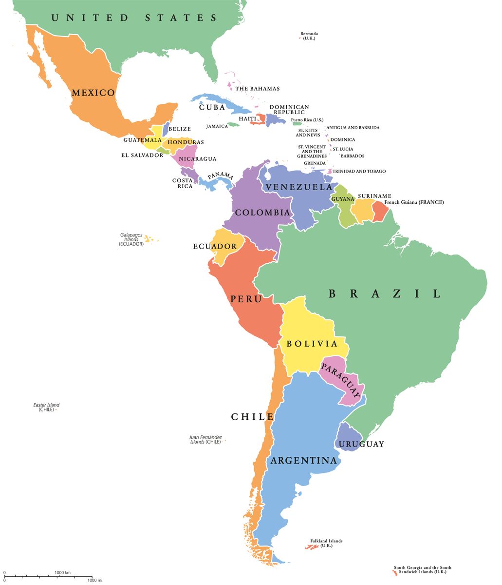
Political map of the Latin America and Caribbean region.