
The Mexican Plateau: A Diverse Landscape and Cultural Heartland
The Mexican Plateau, often called the Mexican Altiplano, is one of northern and central Mexico's most significant geographical features, comprising the vast, arid Mesa del Norte and the smaller, densely populated, volcanically shaped Mesa Central — a divide that also separates Mexico's silver-mining north from its agricultural and demographic heartland.
The Mexican Plateau: Silver Cities and a Desert Divided in Two
The Mexican Plateau, also known as the Altiplano, is a vast highland region in northern and central Mexico that defines much of the nation's geography and cultural heartland. This expanse, characterized by diverse climates and ecosystems ranging from arid northern areas to temperate central regions, is divided into the Mesa del Norte and the Mesa Central. Its varied terrain has profoundly influenced settlement, agriculture, and regional cultures throughout Mexican history, making it both geographically and culturally essential to the nation.
Geographical Features and Extent
The Mexican Plateau, which spans much of northern and central Mexico, is a vast, geographically diverse highland region that profoundly shapes the country's landscape, climate, and cultural heritage. This extensive altiplano stretches from the United States border southward, where its elevated terrain eventually merges with the mountainous landscapes of the Trans-Mexican Volcanic Belt.
Extending over approximately 1,000 kilometers (600 miles) from north to south, the Mexican Plateau covers a significant portion of the country's territory. Bordered by the United States to the north and the Trans-Mexican Volcanic Belt to the south, the plateau occupies a central position within Mexico. Its northern boundary is marked by the Rio Grande (Río Bravo del Norte), a vital river delineating the international border between Mexico and the United States. To the south, the rugged terrain of the Trans-Mexican Volcanic Belt serves as a natural boundary, where the plateau gradually gives way to the volcanic peaks and valleys of central Mexico.
Surrounding Mountain Ranges
Two imposing mountain ranges flank the Mexican Plateau, shaping its distinct topography and climate. To the west lies the Sierra Madre Occidental, a rugged, mountainous range marked by deep canyons, steep slopes, and volcanic peaks. This mountain range serves as a natural barrier, shielding the plateau from the Pacific Ocean's influence and creating a rain shadow effect that contributes to the arid climate of the northern plateau. On the eastern edge of the plateau, the Sierra Madre Oriental rises sharply, its forested slopes contrasting with the plateau's arid landscapes. Together, these mountain ranges frame the plateau and contribute to its unique character.
Distinctive Topography
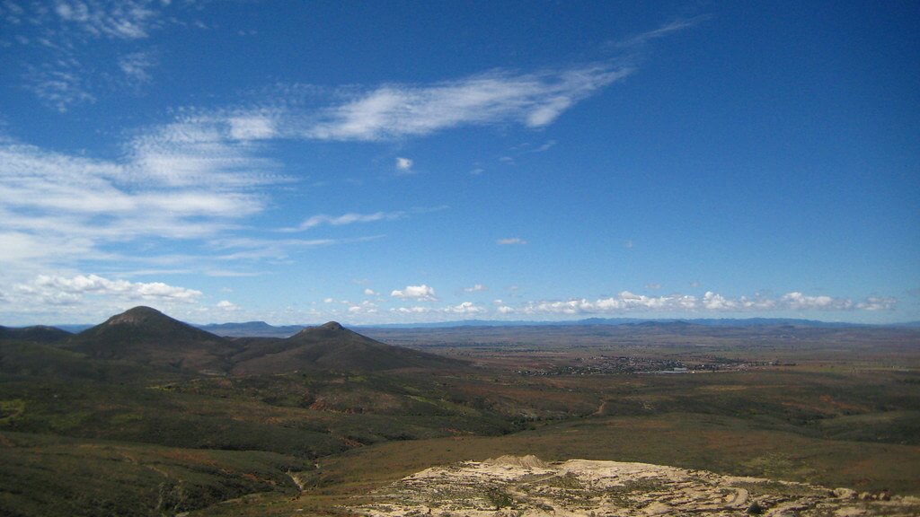
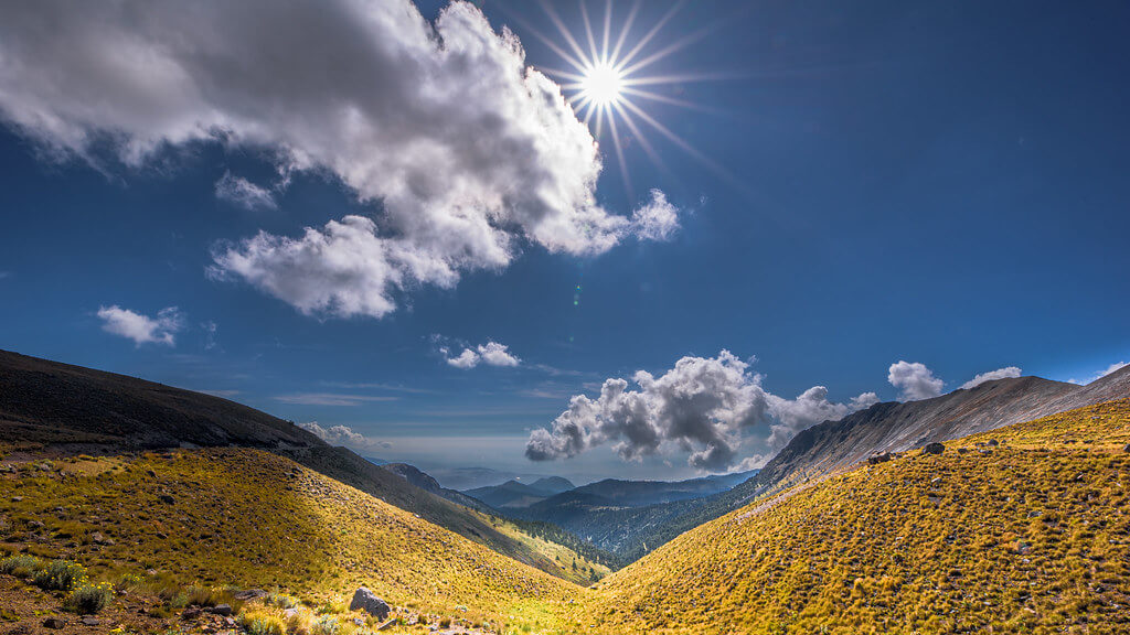
The Mexican Plateau's topography is diverse, ranging from expansive plains and rolling hills to rugged mountains and deep canyons. The plateau's surface is punctuated by mesas, flat-topped hills that rise abruptly from the surrounding terrain, and buttes, isolated hills with steep, vertical sides. Deep river valleys and arroyos carve through the plateau, creating dramatic landscapes and providing vital water sources for the region's inhabitants. The plateau's elevation varies, with some areas reaching over 2,000 meters (6,500 feet) above sea level, while others lie at lower elevations closer to sea level.
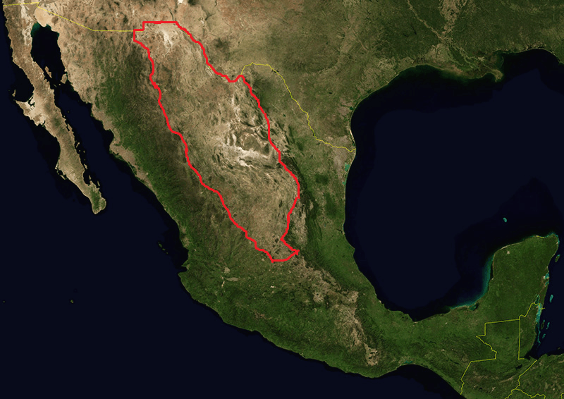
Rough location of the Mexican Plateau.
Hydrology
Despite its arid to semiarid climate, the Mexican Plateau is crisscrossed by numerous rivers and streams originating in the surrounding mountain ranges or underground aquifers. These rivers are vital in providing water for irrigation, industry, and human consumption across the plateau region. The Lerma River, one of Mexico's longest rivers, originates in the highlands of the Mesa Central and flows westward towards the Pacific Ocean, serving as a vital lifeline for agriculture and urban centers along its course. Other major rivers, such as the Santiago and the Pánuco, drain large portions of the plateau before emptying into the Pacific Ocean and the Gulf of Mexico, respectively.
Cultural Significance
The Mexican Plateau holds immense cultural significance for the people of Mexico, serving as the cradle of ancient civilizations and the birthplace of modern Mexican culture. Indigenous peoples have inhabited the plateau for millennia, leaving a rich legacy of art, architecture, and tradition. Today, the plateau is home to vibrant cities, bustling towns, and remote villages, each with a unique cultural identity and heritage, from the ancient ruins of Teotihuacán to the colonial charm of Guanajuato, a testament to the plateau's enduring importance in Mexican history and identity.
Mesa del Norte: Geological Diversity
The Mesa del Norte, encompassing the northern section of the Mexican Plateau, stands as a testament to the rugged beauty and resilience of Mexico's landscape. Spanning states such as Chihuahua, Coahuila, Durango, Zacatecas, and San Luis Potosí, this region boasts dynamic topography marked by narrow ridges, expansive plains, and dramatic depressions, creating a landscape of remarkable diversity and complexity.
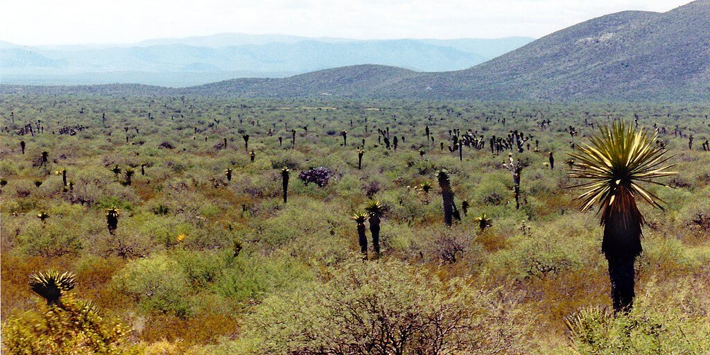
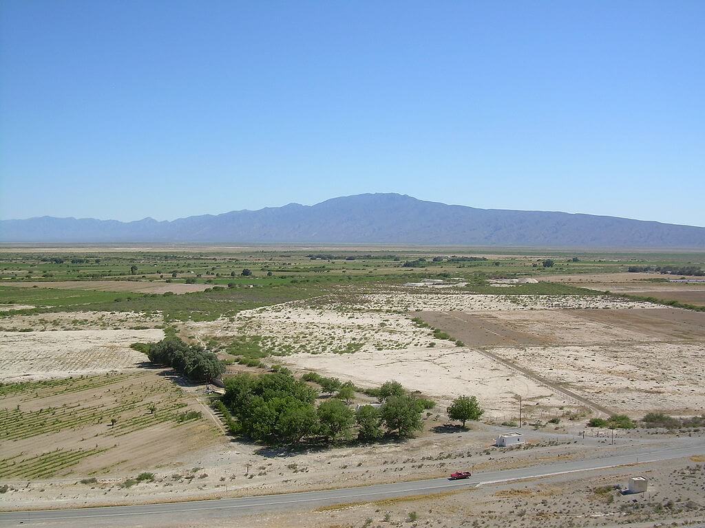
At the heart of the Mesa del Norte lies the expansive Chihuahuan Desert, one of North America's largest and most ecologically significant deserts. Stretching over vast expanses of the northern plateau, the Chihuahuan Desert starkly contrasts with the lush vegetation in other parts of Mexico. Its arid landscapes are punctuated by rugged mountains, deep canyons, and vast stretches of desert scrub, creating a harsh yet captivating ecosystem home to a rich array of plant and animal species.
One defining feature of the Mesa del Norte is the Bolsón de Mapimí, the region's most significant depression. This vast basin, encompassing parts of Chihuahua, Coahuila, and Durango, is characterized by its flat, featureless terrain and extreme climatic conditions. Much of the Bolsón lies within the Mapimí Biosphere Reserve, a UNESCO Man and the Biosphere site established to protect the endemic and endangered Bolson tortoise (Gopherus flavomarginatus), found nowhere else on Earth, alongside the Chihuahuan fringe-toed lizard (Uma paraphygas) and desert-adapted plants such as the creosote bush (Larrea tridentata) and honey mesquite (Prosopis glandulosa).
Hydrological Systems
Crucial river systems crisscross the Mesa del Norte, shaping the region's landscape and providing water for its inhabitants. The Río Bravo del Norte, also known as the Rio Grande, forms the plateau's northern boundary and separates Mexico from the United States. Its tributaries, such as the Río Conchos, drain the northern plateau, carrying water from the mountainous regions of Chihuahua and Coahuila toward the Gulf of Mexico.
Despite these major river systems, a significant portion of the Mesa del Norte comprises internal drainage basins, where water collects in shallow depressions and evaporates or seeps into the ground without reaching the sea. This internal drainage system has significantly shaped the region's hydrology and ecology, creating unique habitats such as salt flats and seasonal wetlands that support a diverse array of specialized plant and animal species.
Ecological Adaptations
The harsh environmental conditions of the Mesa del Norte have created a unique ecosystem adapted to survive in arid and semiarid environments. Vegetation in the plateau's northern expanse is sparse, consisting mainly of desert-adapted shrubs, grasses, and cacti. The southern reaches transition to the Meseta Central matorral, characterized by scrubland and thorn forests.
Despite its challenging climate, the Mesa del Norte supports surprising wildlife diversity, including iconic species like the desert bighorn sheep (Ovis canadensis), pronghorn (Antilocapra americana), and coyote (Canis latrans). Birds such as the greater roadrunner (Geococcyx californianus), cactus wren, and burrowing owl are common in the region, taking advantage of abundant insect life and seasonal water sources.
Mesa del Norte: Cultural Heritage and Silver Cities
Mesa del Norte has a rich cultural heritage spanning thousands of years, with evidence of human habitation dating back to ancient Indigenous civilizations. Its greatest historical wealth, quite literally, came from silver: the city of Zacatecas, founded in 1546 after Basque prospector Juan de Tolosa discovered rich silver deposits nearby, grew into one of New Spain's most important mining centers, its fortunes funding the baroque cathedrals, convents, and palaces that still define its historic center today. The Historic Centre of Zacatecas was recognized as a UNESCO World Heritage Site in 1993, its steep, canyon-hugging street plan and pink cantera-stone architecture standing as one of colonial Mexico's most intact urban landscapes. Today, the wider Mesa del Norte is home to vibrant communities that have adapted to the challenges of life in the desert, preserving traditional practices and customs while embracing modern innovations.
Mesa Central: Volcanic Legacy
The Mesa Central, the southern segment of the Mexican Plateau, is a region of immense geographical diversity and cultural significance. Stretching from the Zacatecas Mountains to the fertile Bajío region, this plateau boasts elevations ranging from 1,800 to 2,300 meters (6,000 to 7,500 feet), creating a landscape that is both breathtakingly beautiful and highly productive agriculturally.
One of the Mesa Central's defining features is its volcanic legacy, which has shaped its topography and ecology over millions of years. Past volcanic activity has blocked numerous streams and rivers, creating expansive shallow lakes and swamps on the mesa. These bodies of water, including Chapala, Pátzcuaro, and Cuitzeo, provide vital habitats for a diverse array of plant and animal species and serve as important reservoirs of fresh water for local communities.
Hydrological Network
A network of rivers and streams crisscrosses the Mesa Central, originating in the surrounding mountains and flowing across the plateau. These rivers nourish the fertile valleys and support a thriving agricultural industry. The Lerma River, in particular, is one of the region's most significant rivers, serving as a vital lifeline for both agriculture and urban centers. Other notable rivers include the Río Grande de Santiago and its tributaries, which drain the southern plateau and flow westward towards the Pacific Ocean.
Valleys of Abundance
The valleys of the Mesa Central, initially shaped by ancient lakes, are among the most productive and densely populated areas in Mexico. These fertile valleys, which crisscross the southern plateau, are home to major cities such as Guadalajara, whose metropolitan area holds more than 5 million people, and Mexico City, whose metropolitan area, home to well over 21 million people, ranks among the largest urban agglomerations on Earth. These valleys serve as the nation's breadbasket, producing a wide variety of crops, including corn, wheat, beans, and vegetables. Their strategic location, rich volcanic soil, and abundant water supply have made them hubs of agricultural, commercial, and cultural activity for centuries.
Mesa Central: The Valley of Mexico
The Valley of Mexico, encompassing Mexico City and its surroundings, is perhaps the most iconic and historically significant part of the Mesa Central. This valley holds a special place in the hearts of Mexicans as the heartland of ancient civilizations, such as the Aztecs, who built magnificent cities and monuments that still stand today as a testament to their ingenuity and cultural achievements. The Valley of Mexico's rich volcanic soil and strategic location have long attracted settlers and traders, making it a center of agricultural, commercial, and cultural development since ancient times.
Conclusion
The Mexican Plateau is a diverse and dynamic region that plays a central role in shaping Mexico's geography, climate, and culture. The Mesa del Norte, a land of stark contrast, pairs rugged mountains and desert landscapes with the silver-built grandeur of cities like Zacatecas, while the Mesa Central, shaped by volcanic activity into fertile valleys and crater lakes, has anchored Mexican civilization from the Aztec Empire to today's megacities. From rugged mountains and deep valleys to storied colonial cities and ancient ruins, the plateau's two halves together capture much of what makes Mexico's past, present, and future distinct.