The Windward Islands: Volcanic Archipelago of the Southern Caribbean
The Windward Islands, a prominent region in the southeastern Caribbean Sea, form part of the Lesser Antilles. This group of islands presents a diverse array of landscapes, from volcanic terrains to lush rainforests, and a rich cultural heritage shaped by historical events and geographical features.


The Windward Islands: Volcanoes, Rainforests, and Caribbean Tradition
The Windward Islands occupy the southern arc of the Lesser Antilles, extending from Dominica in the north to Grenada in the south — a chain of predominantly volcanic islands exposed to the full force of the Atlantic trade winds that blow steadily from the northeast. This exposure, which gave them their name, shaped not only their ecology but also their history: the Windward Islands were harder to approach and defend than their Leeward counterparts to the north, and they changed hands repeatedly among European colonial powers over three centuries of Caribbean rivalry. Today, they form one of the Caribbean's most ecologically significant and culturally vibrant sub-regions, encompassing six independent nations and one French overseas department across a combined land area of approximately 3,235 sq km (1,249 sq mi).
Geology and Landscape
The Windward Islands sit squarely on the inner volcanic arc of the Lesser Antilles, where the North American Plate subducts beneath the Caribbean Plate, generating sustained volcanic and geothermal activity. All the major islands in this group are of volcanic origin and display the characteristic features of recent volcanism: steep conical peaks, deep river valleys, geothermal springs, and soils of extraordinary fertility. This volcanic richness — expressed in the dark, nutrient-dense earth — is one reason the Windward Islands became such intensely contested colonial prizes: the same soils that now support towering rainforest canopies once grew sugarcane, cocoa, and spices that enriched European empires.
Dominica, the northernmost Windward Island, is arguably the most geologically dynamic island in the Eastern Caribbean. Its interior is a landscape of active fumaroles, boiling sulphur springs, and the famous Boiling Lake — at approximately 60 m (197 ft) in diameter, the second-largest flooded fumarole in the world — whose grey-blue waters are maintained at a near-constant 88–92°C (190–198°F) by underlying magmatic heat. Nine distinct volcanic centres dot the island's interior. Morne Diablotins, at 1,447 m (4,747 ft), is the highest peak in the Windward Islands.
At the other end of the chain, Barbados is a geological outlier: a low-lying coral limestone island that sits on the Atlantic side of the arc rather than within the volcanic chain itself. Its highest point, Mount Hillaby, rises to just 340 m (1,115 ft), and the island's character — flat, windswept, and underlain by porous coral rock that filters rainfall into a freshwater lens beneath the surface — is entirely different from the dramatic volcanic profiles of its neighbours.
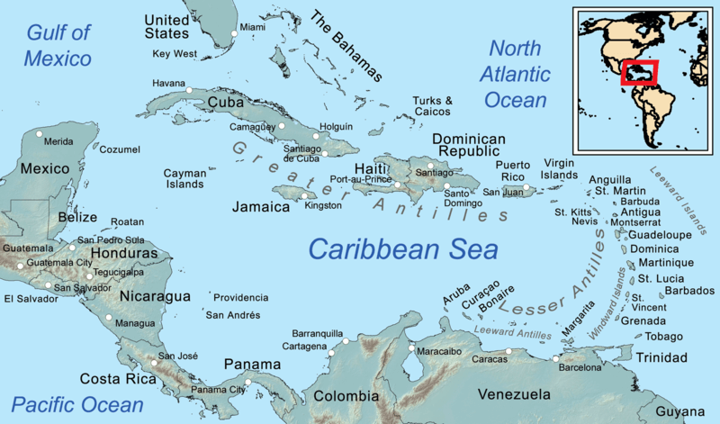
Map depicting the regions of the Caribbean.
Historical Background
The Windward Islands were inhabited by Kalinago (Island Carib) communities at the time of European contact, and the Kalinago fiercely resisted colonisation for much longer than Indigenous peoples elsewhere in the Caribbean. Dominica was effectively left to the Kalinago by the 1660 Treaty of Aix-la-Chapelle, which designated it a neutral island — an arrangement that held for nearly a century before British and French forces finally competed for its possession. Saint Vincent's Kalinago, reinforced by escaped enslaved Africans who had intermarried with them and formed the Black Carib (Garifuna) community, fought two Carib Wars against the British before the entire Garifuna population of approximately 5,000 was forcibly deported to the coast of Central America in 1797 — where their descendants now form the Garifuna nation of Honduras, Belize, and Guatemala, recognised by UNESCO as a heritage of humanity.
Martinique and Saint Lucia changed sovereignty so frequently that Saint Lucia alone is known as the 'Helen of the West Indies' — it changed between British and French control 14 times before remaining British after the Treaty of Paris in 1814. Martinique and Guadeloupe, however, were ceded to France in 1763 and have remained French continuously since, now integrated as overseas regions of the French Republic. Grenada followed a different path: colonised by the French, ceded to Britain in 1763, and independent since 1974, its recent history was shaped by the 1979 leftist revolution of Maurice Bishop and the 1983 US military intervention that followed his assassination. Saint Vincent and Barbados achieved independence in 1979 and 1966, respectively; Dominica became independent in 1978.
Individual Islands
Dominica
With an area of 751 sq km (290 sq mi) and a population of approximately 72,000, Dominica is the least touristically developed of the Windward Islands — a status that has preserved its extraordinary natural environment. More than 60% of the island is covered by primary or secondary forest, and the Morne Trois Pitons National Park, inscribed as a UNESCO World Heritage Site in 1997, protects a landscape of rare volcanic features, including the Boiling Lake, Valley of Desolation, Emerald Pool, and the twin crater lakes of Boeri and Freshwater. The park shelters Dominica's two endemic parrots: the Imperial amazon (Amazona imperialis), known locally as the Sisserou and emblazoned on the national flag, and the Red-necked amazon (Amazona arausiaca), known as the Jacquot. Both species are classified as Endangered by the IUCN, with population estimates of fewer than 1,000 individuals each. Hurricane Maria's devastating passage in 2017 temporarily reduced canopy cover by an estimated 90% in some areas, dealing a severe setback to parrot habitat.
Martinique
Martinique covers 1,128 sq km (435 sq mi) and, with a population of approximately 360,000, is among the most populous of the Lesser Antilles. As a French overseas region, it is fully integrated into the European Union, with the euro as its currency and French metropolitan law as its legal framework. Mount Pelée (La Montagne Pelée) dominates the island's north, rising to 1,397 m (4,583 ft). Its catastrophic eruption of 8 May 1902 sent a pyroclastic flow — a superheated avalanche of gas and volcanic debris — down the mountain's flanks at speeds of up to 670 km/h (416 mph), engulfing the colonial capital of Saint-Pierre and killing an estimated 29,000–30,000 people in minutes. The ruins of Saint-Pierre, sometimes called the 'Pompeii of the Caribbean,' can still be explored today. Martinique is the birthplace of Empress Joséphine, consort of Napoleon Bonaparte, and of the poet and politician Aimé Césaire, co-founder of the Négritude literary movement.
Saint Lucia
Saint Lucia covers 616 sq km (238 sq mi) and is notable above all for the Pitons — Gros Piton (771 m / 2,530 ft) and Petit Piton (743 m / 2,438 ft) — twin volcanic spires that rise directly from the sea near the town of Soufrière and form part of the Pitons Management Area, a UNESCO World Heritage Site. The surrounding volcanic landscape includes a drive-in volcano (a geothermal field of fumaroles and boiling mud) and a coral reef system of exceptional health and diversity, where healthy populations of parrotfish (family Scaridae), angelfish (family Pomacanthidae), and coral trout (Cephalopholis miniata) are maintained within the marine reserve. Saint Lucia was the birthplace of two Nobel laureates: the economist Sir William Arthur Lewis (1979) and the poet Derek Walcott (1992), making it, per capita, one of the most Nobel-decorated nations on earth. The island's French Creole language, known as Kwéyòl, is spoken by the majority of the population alongside English.
Saint Vincent and the Grenadines
Saint Vincent and the Grenadines is a nation of 389 sq km (150 sq mi) composed of Saint Vincent itself and a chain of 32 islands and cays stretching 90 km (56 mi) southward to Grenada. Saint Vincent is dominated by La Soufrière, an active stratovolcano whose summit reaches 1,234 m (4,049 ft). The volcano erupted explosively in April 2021, the most significant eruption since 1979, blanketing much of the island in volcanic ash and forcing the evacuation of approximately 20,000 people from the northern third of the island. The island's Vermont Nature Trail and Mesopotamia Valley support the Saint Vincent amazon (Amazona guildingii), a large, spectacularly coloured parrot endemic to the island and classified as Vulnerable, with a population estimated at 700–1,000 individuals.
The Grenadines offer a completely different character from Saint Vincent's volcanic interior: low, coral-fringed islands and cays of extraordinary beauty, famous for their sailing waters and the Tobago Cays Marine Park. Mustique, privately developed as an exclusive resort in the 1960s, became synonymous with celebrity retreats. Bequia, the largest of the Grenadines at about 18 sq km (7 sq mi), is a traditional boat-building centre whose craftsmen still construct wooden sloops using methods unchanged for generations.
Grenada
Grenada, covering 344 sq km (133 sq mi), is the southernmost nation in the Windward Islands chain and is known globally as the 'Spice Isle.' The island produces approximately 20% of the world's supply of nutmeg (Myristica fragrans), introduced by the Dutch in the 18th century, as well as significant quantities of mace, cinnamon, cloves, and cocoa. Grand Etang National Park protects the island's forested volcanic interior, including Grand Etang crater lake at 530 m (1,739 ft) elevation, surrounded by cloud forest and home to the endemic Grenada dove (Leptotila wellsi), one of the rarest doves in the world, with a total population estimated at fewer than 200 individuals.
Barbados
Barbados, at 430 sq km (166 sq mi), sits apart from the volcanic chain on the Atlantic side of the Windward Islands — geographically isolated but historically and culturally central to the English-speaking Caribbean. The first English colony established in the region (1627) and the last to become independent (1966), Barbados maintained the most productive sugar economy in the British Caribbean for more than two centuries, with an enslaved population that outnumbered the white plantation class by a ratio of approximately five to one by the 18th century. This history is explored with increasing depth and candour at sites such as the Barbados Museum and Historical Society and the recently developed Barbados Slavery Heritage Trail.
The Crop Over festival, originally a celebration marking the end of the sugarcane harvest, has evolved into one of the Caribbean's most exuberant carnivals, culminating in the Grand Kadooment parade on Kadooment Day. Harrison's Cave, a series of crystallised limestone caverns extending through the island's coral cap, offers a rare geological contrast to the volcanic scenery found throughout the rest of the Windward chain.
Shared Ecology
The Windward Islands lie at the heart of one of the Caribbean's most biodiverse subregions. The continuous band of humid forest that once covered the volcanic interiors of Dominica, Martinique, Saint Lucia, and Saint Vincent constituted an island arc of forest habitat in which many species evolved in relative isolation, generating high endemism. Hummingbirds are particularly well represented: the Antillean crested hummingbird (Orthorhyncus cristatus) is found throughout the chain, but each major island also has at least one endemic species, such as the Purple-throated carib (Eulampis jugularis) and the Blue-headed hummingbird (Cyanophaia bicolor) in Dominica.
Sea turtle nesting is significant throughout the Windward Islands. Leatherback sea turtles (Dermochelys coriacea), the world's largest living reptile, nest in substantial numbers on Dominica's beaches and on the beaches of Saint Lucia's Fond d'Or Bay. The hawksbill turtle (Eretmochelys imbricata) and green turtle (Chelonia mydas) also nest across the region, and all three species are protected by law throughout the chain. Dominica's waters are known for their resident population of sperm whales (Physeter macrocephalus), which use the deep waters off the island's west coast year-round.
Conservation and Future Challenges
The Windward Islands face environmental challenges that are, in some respects, more acute than those confronting the flatter Leeward Islands to the north. Their volcanic topography makes them more susceptible to landslides and flash flooding during extreme rainfall events, which are expected to intensify under climate change scenarios. Their isolation from continental markets, combined with the high costs of import-dependent economies, makes the transition to sustainable energy and food production both more urgent and more difficult.
The catastrophic impact of Hurricane Maria on Dominica in 2017 — which destroyed an estimated 90% of the island's buildings and caused damage equivalent to 226% of GDP — has given the island the impetus to pursue its stated ambition of becoming the world's first 'climate resilient nation,' rebuilding with reinforced construction standards and expanded renewable energy capacity. Saint Vincent's 2021 volcanic eruption, the COVID-19 pandemic, and ongoing hurricane risk illustrate the vulnerability of small island developing states to natural hazards that dwarf their capacity for self-recovery without international support.
Marine conservation in the Windward Islands has advanced significantly in recent decades. Saint Lucia's Soufrière Marine Management Area, established in 1994 as one of the Caribbean's pioneering examples of co-managed marine reserves, demonstrated measurable recovery of fish biomass and reef health within years of its creation — a model subsequently replicated elsewhere in the region. Dominica's ocean protection initiatives, including the proposed establishment of one of the world's largest marine protected areas around the island, aim to extend these gains across the full expanse of its exceptionally rich waters.
Conclusion
The Windward Islands offer one of the Caribbean's most complete and compelling portraits of nature, history, and human resilience. From Dominica's boiling lakes and cathedral forests to Grenada's nutmeg groves, from the ruins of Saint-Pierre to the sailing waters of the Tobago Cays, they embody the extremes that make the Caribbean endlessly fascinating — geological violence and biological abundance, colonial trauma and cultural creativity, vulnerability and fierce determination. They are, in every sense, islands that reward discovery.